
Everything has a spatial context
One Stop Shop
Expert Information Services
Expert Information Services

We offer comprehensive GIS services. We are task oriented and break down our approach in clearly defined terms. We are ready to provide GIS capacity from data collection through all aspects of the project. Including processing, analytics, visualizations, and industry governance for delivery compliance. We remain flexible to suit an entire research project or just one task.
Expert Information Services
Expert Information Services
Expert Information Services
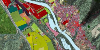
We are seasoned professionals with extensive experience in the private and public sector providing GIS support across platforms and applications. Including disaster mitigation & recovery, risk & vulnerability assessments, aerial data collection & remote sensing with multiple sensor types. We also work in urban/regional planning, transportation, utilities, natural resources, and conservation.
Technology
Expert Information Services
Technology

For aerial data collection we use NDAA compliant UAVs equipped with a customer specific, aerial sensor payload. For mapping and spatial data services we utilize a vast network of data repositories for open-source data acquisition. We have years of experience building and managing spatial databases and conducting spatial analytics, carefully configured, to return high precision accuracy.

Talent
Talent
Talent
Our professional employment has been within all levels of government and within the private sector too. Building spatial analytics for project specific questions. Our evidence is our work, published in mapping of urban and rural landscapes, hazards, habitat, population dynamics and data relationships.
Story
Talent
Talent
When the unexpected happens, we adapt. We are here to help you navigate your GIS and spatial data challenges.
Team
Talent
Team
We understand the complexity of geospatial workflows and how to integrate spatial data where appropriate. Holding industry certifications in GISP and CFM, also operating with FAA UAV Commercial Pilot license.